A brief History of Samtse Dzongkhag...
Before Bhutan’s hereditary monarchy was established, Samtse was divided into eastern and western administrative regions. The western region, including present-day Norbugang, Ugyentse, Yoeseltse, and others, was under Gongzin Sonam Tobgay Dorji of Kalimpong, while the eastern region, covering Samtse, Tading, Pagli, and parts of Dorokha, was controlled by Dewan and Kazi under the Paro Penlop. Administrative centers included Saurini Kothi for summer and Dorpani for winter. Governance was structured with Mandals (gups) overseeing tax collection and local law enforcement, with major cases forwarded to higher authorities. In the 1950s, Raja Sab Gongzin Sonam Tobgay Dorji appointed Babu Tshewang Dorji as the first District Commissioner, establishing Samtse as a headquarters for five sub-divisions. By the 1970s, Samtse was formally designated as a Dzongkhag headquarters with its current administrative structure.
Present
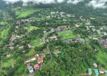
Borders: Chukha (E), Haa (N), West Bengal (S), Sikkim (W). Elevation: 600-800m, Climate: Subtropical monsoon. Temperature: 15°C (winter) – 30°C (summer). Rainfall: 1500-4000 mm annually. People & Settlements: Lhotshampas, Doyaps and Adibashi. 1998-99 Resettlement: People from other Dzongkhags moved into several gewogs.
2006
194.8 sq. km transferred to Haa Dzongkhag. Samtse reduced to 1309.1 sq. km with 2 Drungkhags and 15 gewogs.
2005
Samtse covered 1582 sq. km with 2 Dungkhags and 16 gewogs.
1970s
Samtse established as a Dzongkhag headquarters.
1950s
Babu Tshewang Dorji appointed as first District Commissioner. Samtse became headquarters for five sub-divisional offices.
Pre-1907
Samtse was divided into Eastern and Western administrative regions; Western Region: Under Gongzin Sonam Tobgay Dorji and Eastern Region: Under Dewan and Kazi, reporting to Paro Penlop. Saurini Kothi (summer) and Dorpani (winter) served as administrative offices.


Samtse Dzongkhag Administration
- Samtse, BHUTAN
- PA to Dzongdag No.:05-365227
- Help Desk-05-365714
- Post-Box # 321
- Webmaster info
- Email : samtseinfo@samtse.gov.bt
- Phone: 05 365601(ICT)
